Rivers systems are powerful forces of landscape evolution and change on Earth.
The abundance of water on Earth guarantees a large number of major river systems
whose flowing water continually erodes material from the continents and transports
the sediment to the ocean basins.
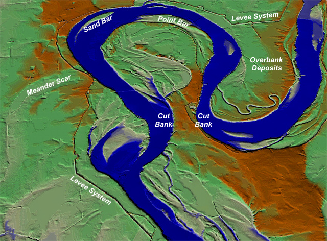
This virtual view shows a large meander of the Mississippi River near the
community of New Madrid, Missouri, USA. This image was generated from a digital
elevation model and shows exquisite detail of the fluvial plain constructed
by this river.
At the far right, overbank deposits (sediment deposited during floods) are
clearly evident along the river bank. In addition, a man-made levee system
is visible. This system of low earthen walls is intended to serve as an auxiliary
river bank to contain the river during floods.
 <a onClick="window.open('/olcweb/cgi/pluginpop.cgi?it=jpg:: ::/sites/dl/free/0072402466/30425/VirtualVista1001.jpg','popWin', 'width=NaN,height=NaN,resizable,scrollbars');" href="#"><img valign="absmiddle" height="16" width="16" border="0" src="/olcweb/styles/shared/linkicons/image.gif"> (369.0K)</a>
Other obvious features in this view are a point bar, cut banks, mid-channel
sand bars, and meander scars marking the former path of the river. The narrow
neck separating the two cut banks is a likely place for the river to cut-off
the active meander during a large flood. Once isolated from the main body
of the river's flow, the meander will evolve into an oxbow lake.
This image was generated from digital elevation models of four 7.5-minute
quadrangles merged into a single image using Geographic Information System
(GIS) software.