(See related pages)
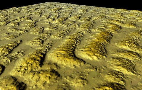
Virtual Vista: Sand Hills, Cherry County, Nebraska, USA Strip the grass from the high plains of north-central Nebraska and you are left with spacious skies and amber waves of…sand! The Nebraska Sand Hills occupy over 50,000 square kilometers of north-central Nebraska and south-central South Dakota. The image below views a small portion of the sand hills region looking toward the northeast along the axis of a field of transverse dunes.
Other forms of sand dunes are found among the sand hills, and many dunes reach heights of tens of meters. Small, shallow lakes commonly occupy the interdune lows throughout the sand hills region. Though the original morphology of these dunes has been greatly modified by wind, rainfall, and vegetation over thousands of years, it is still possible to identify the asymmetry of the dune profiles if you look carefully.
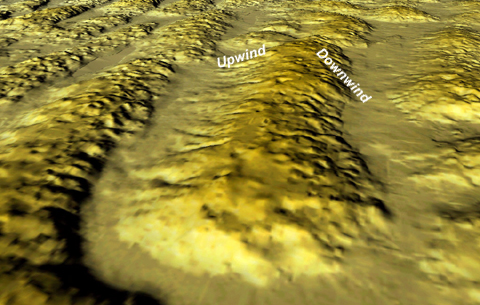
The left-hand side of the dune in the image above faces northwest and has a somewhat gentler slope than the right-hand side of the dune (facing southeast). The gentler slope is on the upwind side of this transverse dune, indicating a dominant wind blowing from the northwest toward the southeast. To learn more about the Nebraska Sand Hills, you can read An
Atlas of the Sand Hills, a publication of the Conservation
and Survey Division of the Institute of Agriculture and Natural Resources
in Nebraska. |

