(See related pages)
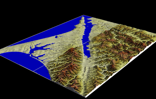
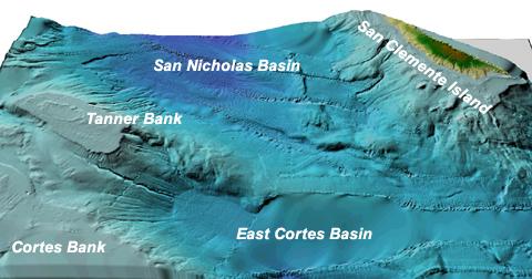
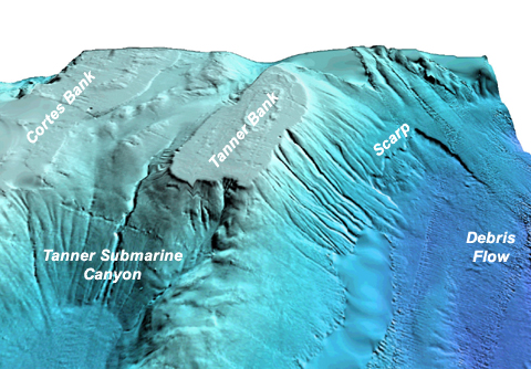
Virtual Vista: Pt. Reyes, California, USA To take a flight over a virtual landscape of Pt. Reyes and the San Andreas Fault, click on the link below Points to Ponder: Having trouble loading or viewing the video clip? You will need the DivX video codec for your media player to watch the video. The DivX codec is available free from www.divx.com. Click on the link or type the URL into your browser to go to the DivX download site. Once at the DivX site, follow the "DOWNLOAD" links until you locate the download "Standard DivX Codec (FREE)" hyperlink. Click on the link and download the small DivX codec file. The codec file may take a few minutes to load. Please be patient. Once the file is downloaded to your local computer, double click on the file to automatically install the Divx codec.You may also discover that the Virtual Vistas work best with the Windows Media Player, available as a free download from www.microsoft.com. Click on the link or type the URL into your browser to go to the Microsoft web site. Once at the web site, type "windows media player" into the Search box, then click on the appropriate link to download the latest version of Windows Media Player.Virtual Vista: The Southern California Continental Borderland, USA To take a virtual flight around the Southern California Borderland, click on the link to the video clip below. 1. Consider the sea-level video from the Ch.14 Virtual Vista. How much of Cortes and Tanner Banks do you think was exposed during the sea-level lowstand (125 m below present sea-level) of the last glacial maximum?Having trouble loading or viewing the video clip? You will need the DivX video codec for your media player to watch the video. The DivX codec is available free from www.divx.com. Click on the link or type the URL into your browser to go to the DivX download site. Once at the DivX site, follow the "DOWNLOAD" links until you locate the download "Standard DivX Codec (FREE)" hyperlink. Click on the link and download the small DivX codec file. The codec file may take a few minutes to load. Please be patient. Once the file is downloaded to your local computer, double click on the file to automatically install the Divx codec.You may also discover that the Virtual Vistas work best with the Windows Media Player, available as a free download from www.microsoft.com. Click on the link or type the URL into your browser to go to the Microsoft web site. Once at the web site, type "windows media player" into the Search box, then click on the appropriate link to download the latest version of Windows Media Player. |