|
| Home | Introduction | Tsunami of 2004 | Tsunami Science | Internet Exercise | Other Tsunamis | Tsunami Links | |
Introduction:
At 00:58:53 UTC on 26 December 2004, a great earthquake with preliminary moment magnitude (Mw) = 9.0 occurred at a depth of 30 km offshore of the northeast coast of the island of Sumatra, Indonesia. This event was the largest earthquake since the Good Friday Earthquake in Alaska, U.S.A. in 1964. This earthquake also spawned a series of tsunamis that devastated coastal zones and islands throughout the Indian Ocean basin, resulting in perhaps the greatest natural disaster to affect human cultures in recorded history. The following information regarding this earthquake was taken from the United States Geological Survey "Preliminary Earthquake Report".
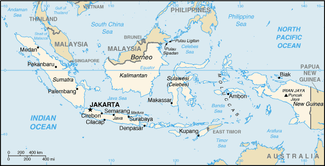
Location map of Indonesia from the National Earthquake
Information Center
(http://neic.usgs.gov/neis/bulletin/neic_slav_l.html)
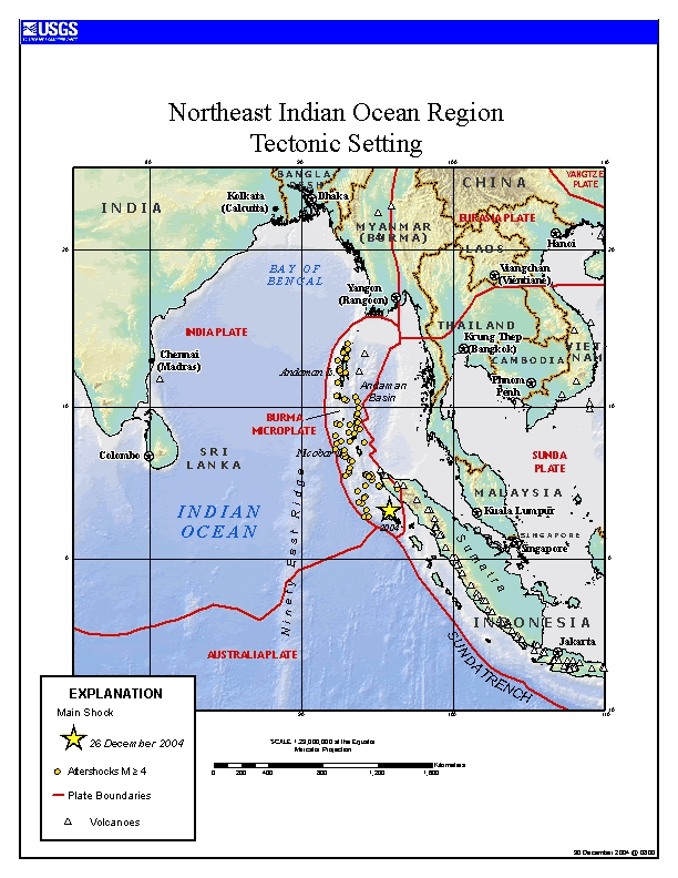
Tectonic Setting:
The great earthquake of 26 December 2004 occurred where the Indian plate is being subducted beneath the Burma microplate. In this region, the motion of the Indian plate relative to the Burma microplate is northeastward at an average rate of approximately 0.06 meters per year (approximately 2.4 inches per year).
Tectonic Setting of Earthquake of 26 December 2004 from United States Geological Survey
(http://earthquake.usgs.gov/eqinthenews/2004/usslav/)
Historical Seismicity and Great Earthquake of 26 December 2004:
Persistent seismicity related to ongoing subduction processes in this region leads to many earthquakes annually, some of which are of damaging magnitudes (greater than Mw 6.5). A well-defined Benioff Zone, where earthquake hypocenters become progressively deeper (from near-surface events to maximum depths of approximately 300 km), is evident as one moves northeastward from the Sunda Trench (purple line below) across the island of Sumatra.
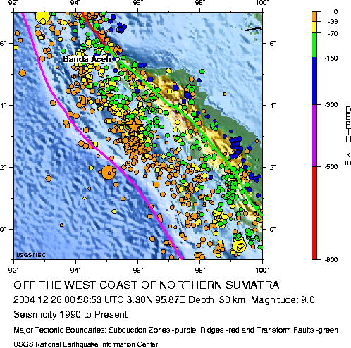
Map showing historical seismicity (1900
- 2004) from the National Earthquake Information Center
(http://neic.usgs.gov/neis/bulletin/neic_slav_l.html)
As such, the devastating earthquake of 26 December 2004 (star on image below) occurred in an area of well-known historical seismicity at the boundary of two lithospheric plates.
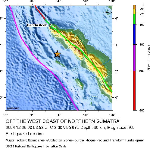
Map showing epicenter (star) of earthquake from the National
Earthquake Information Center
(http://neic.usgs.gov/neis/bulletin/neic_slav_l.html)
Tsunami of 26 December 2004:
Preliminary estimates of the rupture zone from this earthquake suggest an area of significant disturbance 1,200 km long and 100 km wide. It is hypothesized this area of rupture had an average fault displacement of at least 15 m resulting in uplift of the seafloor on the overriding plate of perhaps several meters. It is this uplift that is responsible for excitation of tsunamis that devastated the shores of the Indian Ocean basin.
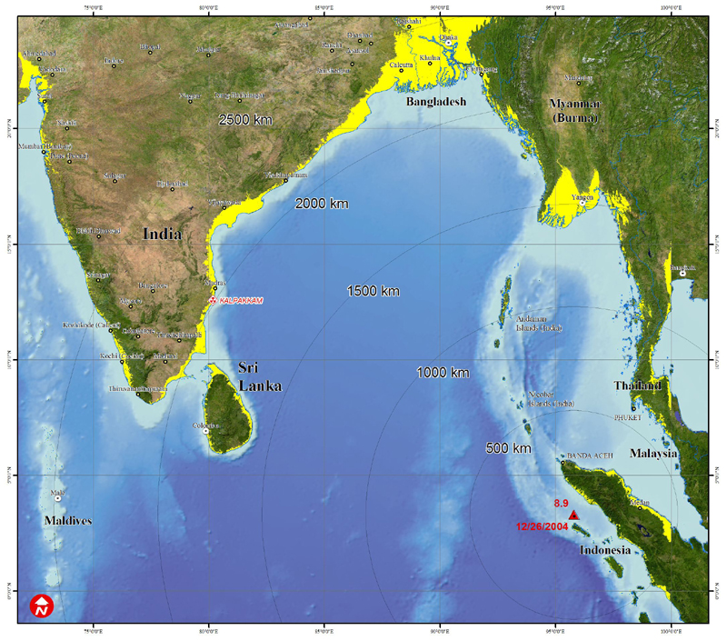
Areas Potentially Affected by Tsunami of 26 December
2004 from UNOSAT
(www.unosat.org)
In the image above, shore zones of the Indian ocean at elevations less than 20 m above sea-level are depicted in yellow. These are maximum areas that were potentially impacted by tsunamis on 26 December 2004. Ongoing investigations in potentially affected areas are attempting to assess actual tsunami impacts.
| Previous Page | Next Page |