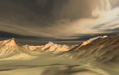
The images of this Virtual Vista represent one of the most breathtaking of
the United States national parks - Glacier National Park - which straddles
the northern border of the United States and Canada (Waterton Glaciers National
Park). Digital terrain models of four 7.5-minute quadrangles located in Glacier
National Park, Montana, USA were rendered using Geographic Information System
software.
The result is a remarkably realistic looking virtual landscape illustrating
many of the alpine glacial landforms you studied in class.
 <a onClick="window.open('/olcweb/cgi/pluginpop.cgi?it=jpg:: ::/sites/dl/free/0072402466/30425/VirtualVista1201.jpg','popWin', 'width=NaN,height=NaN,resizable,scrollbars');" href="#"><img valign="absmiddle" height="16" width="16" border="0" src="/olcweb/styles/shared/linkicons/image.gif"> (97.0K)</a>
 <a onClick="window.open('/olcweb/cgi/pluginpop.cgi?it=jpg:: ::/sites/dl/free/0072402466/30425/VirtualVista1203.jpg','popWin', 'width=NaN,height=NaN,resizable,scrollbars');" href="#"><img valign="absmiddle" height="16" width="16" border="0" src="/olcweb/styles/shared/linkicons/image.gif"> (170.0K)</a>
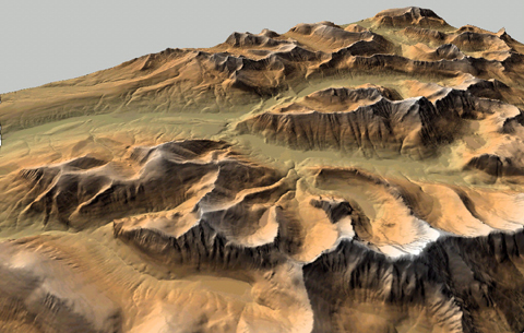
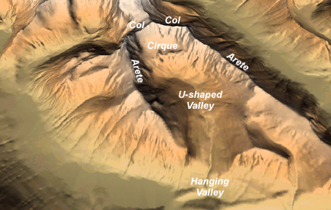
On the image above, try to identify as many glacial landforms as you can.
Some glacial landforms are identified and presented in the image that follows.
 <a onClick="window.open('/olcweb/cgi/pluginpop.cgi?it=jpg:: ::/sites/dl/free/0072402466/30425/VirtualVista1202.jpg','popWin', 'width=NaN,height=NaN,resizable,scrollbars');" href="#"><img valign="absmiddle" height="16" width="16" border="0" src="/olcweb/styles/shared/linkicons/image.gif"> (152.0K)</a>
To learn more about Glacier National Park and the geologic processes that
shaped its history, visit the National Park Service
website for this park.